Seismometers
Introduction
Seismometers are instruments which measure local ground motions, mainly seismically induced processes. In general the measurements are performed in three direction components:
- the vertical direction and
- the North-South (NS) and East-West (EW) direction.
- Many earthquakes have been felt in Luxembourg including:
- Roermondt (The Netherlands), 13 April 1992, magnitude 5.8
- Theux (Belgium), 24 July 1996, magnitude 3.5
- Koblenz (Germany), 20 January 2000, magnitude 3.9
- Eschweiler (Germany), 22 July 2002, magnitude 5.1
In fact, the seismometers here in Luxembourg record earthquake activity every day from all over the World even if we humans cannot feel them.
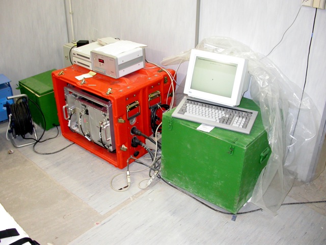
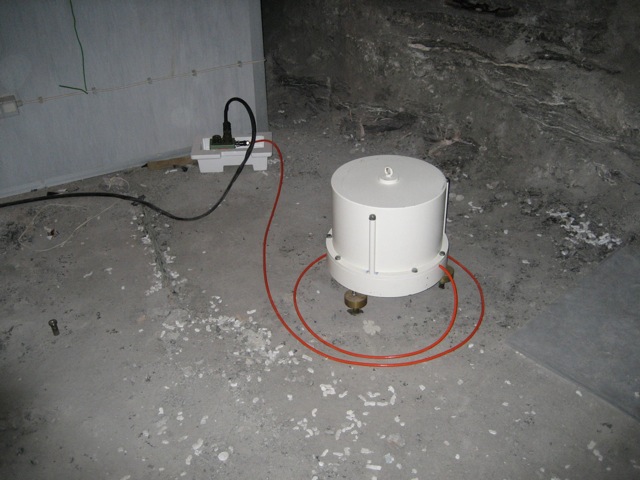
Two types of seismometers are generally in use: the broadband seismometers like the seismometer STS-2 for worldwide events and short-period seismometers, like the SP-Lennartz seismometer for local or regional earthquakes.
From the recordings of earthquakes, one can extract information on the internal structure of the Earth.
The GEOFON-Station with Seismometer STS-2
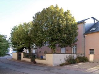
The broadband seismometer STS-2, which is part of the GeoForschungsZentrum Potsdam (Germany) permanent GEOFON network, is installed in the Walferdange Underground Laboratory for Geodynamics to record daily earthquake activity from all over the World even if we humans cannot feel them.
The worldwide GEOFON Network from GFZ-Potsdam, Germany. Image courtesy: GFZ-Potsdam
A live seismogram of the STS2-station installed in the Walferdange Underground Laboratory can be viewed on GFZ-Potsdam webpage.
Examples of recorded earthquakes
Aquila, Italy earthquake, 2009
Here is an example graph of the earthquake occurred in Aquila, Italy in the morning of April 6th, 2009 and recorded in the gypsum mine of Walferdange with the broadband STS-2 seismometer:
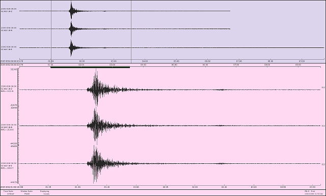
Aquila, Italy Earthquake from April 6, 2009, Magnitude 6.3
Haiti earthquake 2010
The broadband STS-2 in the mine recorded the Haiti earthquake too.
Here’s the seismograph of the Magnitude 7.0 Haiti Earthquake, occurred on January 12, 2010 at 21:53:10 UTC and recorded with the GEOFON STS-2 in the gypsum mine of Walferdange.
Note that the earthquake occurred at 21:53:10 UTC (epicenter), but the first waves arrived about 10 minutes later in Walferdange, source: USGS
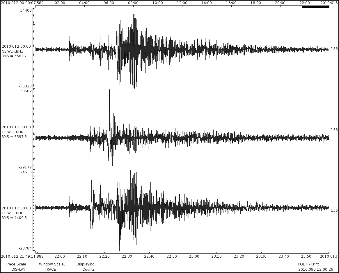
Haiti earthquake from January 12, 2010, Magnitude 7.0, Depth 13km,
The ORB Seismological Network Station with Seismometer SP-Lennartz
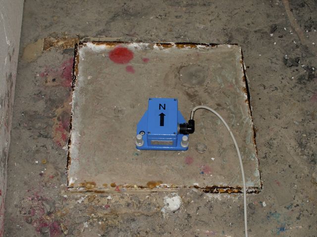
The short-period (SP) Lennartz LE-2D seismometer from the Royal Observatory of Belgium (ORB) is installed in the Walferdange Underground Laboratory for Geodynamics.
The Seismometer SP-Lennartz is part of ORB’s seismological network showed on this map:
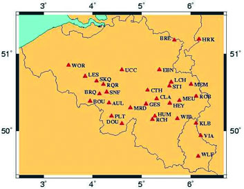
As you can see on the map, two other seismoligical stations are installed in Kalborn (KLB) (SP-Lennartz) and in the castle of Vianden (VIA) (SP-Lennartz LE-3D).
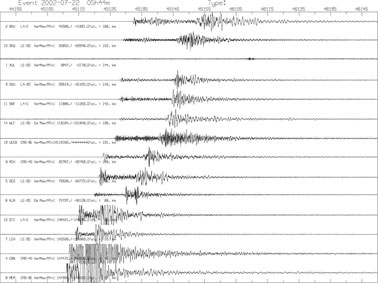
Here is an example of an earthquake recorded in the Underground Laboratory of Walferdange with seismometer SP-Lennartz LE-2D:
On July 22, 2002 at 5h45 an earthquake occurred near the city of Eschweiler in Germany,
along the western border of the Roer Graben – the more active region of Western Europe: