Ongoing Projects
SLIDE project
Assessing the contribution of slow moving landslides to erosion in the Himalayas by means of remote sensing and ground-based measurements.(ANR/FNR fund) More information here : https://anr.fr/Projet-ANR-24-CE01-4014
Past Projects
BEDLOAD project
Investigation of bedload transport with seismometers and with hydrophones (FNR fund). More information here : https://app.dimensions.ai/details/grant/grant.6440091
GORISK project
GORISK project: the combined use of Ground-Based and Remote Sensing techniques as a tool for volcanic risk and health impact assessment for the Goma region (North Kivu, Democratic Republic of Congo). Read more on the webpage: https://gorisk.ecgs.lu
GEORISCA
GEORISCA (Geo-Risk in Central Africa: integrating multi-hazards and vulnerability to support risk management) is a project funded by BELSPO and led by the Royal Museum for Central Africa. See description here.
MODUS
MODUS (A Multi-sensOr approach to characterize ground Displacements in Urban Sprawling contexts) is a project funded by BELSPO and led by the Royal Museum for Central Africa. See description here.
SMMIP
SMMIP (Split band assisted Multi-dimensional and Multi-zonal InSAR time series Processor) is a project funded by FNR. See description here. See here how to request related software.
RESIST
RESIST (REmote Sensing and In Situ detection and Tracking of geohazards) is a project funded by BELPO and FNR and led by the Royal Museum for Central Africa. See description here.
MUZUBI
Muzubi (MUlti Zone phase Unwrapping using advanced Split Band Interferometry) is a project funded by BELSPO and led by the Centre Spatial de Liège. See description here or here. Related software can be requested here.
NYALHA Project – Dynamics of volcanic activity and lava flow hazard of Nyiragongo volcano (North Kivu, DRC) studied by means of remote sensing, ground-based monitoring and numerical modelling
NYALHA is a PhD project funded by the FNR through the AFR PhD Grant Scheme (AFR Grant n°3221321) and is performed at the European Center for Geodynamics & Seismology, in collaboration with the Vrije Universiteit Brussel (Belgium) and the Royal Museum for Central Africa (Belgium). This project focuses on the study of the mechanisms that control Nyiragongo activity and the assessment of the potential impact of new lava flows resulting from the drainage of the lava lake.
Vi-X Project – Study and monitoring of Virunga volcanoes using TanDEM-X
The Virunga Volcanic Province, in the western branch of the East African Rift, extends over 3 countries: D.R. Congo, Rwanda and Uganda. Among its 8 main volcanic edifices, two are very active: the Nyiragongo and the Nyamulagira, in D.R. Congo. Nyiragongo volcano and its semi-permanent lava lake threaten the city of Goma (± 1 Mo inhabitants) distant of ~ 12 km. Its silica-undersaturated lavas form low-viscosity flows that can reach 20 km/h in flat urban areas. The last eruption in January 2002 devastated approximately 10 % of the city, including major infrastructures (roads, airport, public and private buildings). Nyamulagira volcano is located 5 km NNW of Nyiragongo and erupts every ~ 2-4 years. Its lava flows repeatedly destroy large forested areas of the Virunga National Park. Beside the direct threat of volcanic products, other volcanic related hazards are affecting the region like gas emanation or the intense erosion of the dormant volcanoes that also often triggers dangerous mudflows during high precipitation events, which destroy villages and crops as it occurred in May 2010.
Synthetic Aperture Radar Interferometry for mapping natural and anthropogenic hazards
The aim of this work is monitoring ground deformation produced by volcanic, seismic and anthropogenic sources and modeling observed ground deformation for derivation of various geophysical parameters.
LUXBB: temporary deployement of six broadband seismic stations in Luxembourg
In a collaborative project between the European Center for Geodynamics and Seismology and the Geophysical Institute of the Karlsruhe Institute of Technology (KIT), six broadband seismic stations from the Karlsruhe Broadband array (KABBA) are deployed in Luxembourg for a timespan of 12-18 months. The deployment started in December 2009 and currently, four of the six planned sites are fully operational.
Analyzing earthquake ground motions: insights into source characteristics, seismic attenuation and site amplification
The observed ground motion resulting from an earthquake is the convolution of mainly three contributing factors: source, path and site effects. In order to get better insights into earthquake source physics and the attenuation of seismic waves in the Earth’s crust as well as to improve seismic hazard estimates, it is necessary to separate these contributions from each other.
CORSAIR – COntinental Rift SAr InteRferometry
Continental rifting comprises in a single term, one of most complex geodynamical settings of the plate tectonics. The pan-African rift valley is the largest continental rifting zones in the globe, as a dichotomy is also one of the less known plate boundaries. Deformation measurements has been proved of capital importance to decipher the driven-force mechanism sources involved from plate-scale tectonics, through regional seismogenic faults to local-scale magmatic plumbing systems.
Using GPS and Gravity to Infer Ice Mass Changes in Greenland
Climate research indicates that global warming is occurring and will probably continue to occur for the next several decades. One consequence of a global warming scenario is a global sea level rise that would be expected from 1) the thermal expansion of the near surface ocean water and 2) the melting of the Antarctic and Greenland ice sheets and continental glaciers.
International Intercomparison of Absolute Gravimeters
On November 3rd to November 7th 2003, Luxembourg’s European Center for Geodynamics and Seismology (ECGS) hosted an international intercomparison of Absolute gravimeters in their Underground Laboratory for Geodynamics in Walferdange (WULG).
The GRAVILUX project
The Grand Duchy of Luxembourg is establishing a new International Reference Station for Intercomparisons of Absolute Gravimeters (ISIAG). The station is located in the Walferdange Underground Laboratory for Geodynamics 100 meters below the surface. Since 1967, the laboratory has been used for Earth tides research and from that work has gained an international reputation as a seismogenically quiet location where sensitive instruments can be tested and evaluated.
Information
ECGS office address
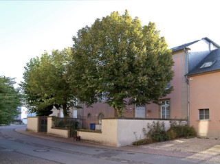
19, Rue Josy Welter
L-7256 Grand-Duchy of Luxembourg (Europe)
tel: +352 331487-1